Updated: August 1, 2009
Today, we have another interesting, unique educational software - Marble. Marble is a geographical map program, somewhat similar to Google Earth/Google Maps. However, unlike Google Earth, which requires 3D acceleration to work properly, Marble requires no special graphics and will run well even in virtual machines using a generic display driver.
Marble is available for all major operating systems. It also comes in two flavors, the Qt and KDE versions. The latter version is the recommended one, as it provides some additional features that are missing in the Qt version. The KDE version also comes as a full blown live CD.

Live CD
I decided to test the live CD first.

The distro, so to speak, boots directly into Marble. However, the live experience was a little flawed for me. I had no access to a wired network when I tested Marble on my T42 laptop, while wireless drivers were completely missing. This prevented me from downloading additional software, like Ksnapshot, preventing me from documenting my session. I also tested it in a virtual machine and it would not complete the boot.
Marble as an application
I had to resort to install Marble on top of my Jaunty Gnome desktop. Despite warnings of reduced functionality, everything worked smoothly. Maps were downloaded automatically when found missing and the KDE looks blended well with the distro, making for a visually pleasing experience.

Marble is spectacular
I was tremendously pleased with the application looks, feel and behavior, growing more satisfied by the minute. The application was purring along, fast and responsive, without any hint of being hampered by the lack of 3D acceleration. Marble has many modes, all of which offered different results.
Geopolitical maps
The most basic usage is plain geopolitical maps, showing countries, their borders and cities in the classic topographic colors.
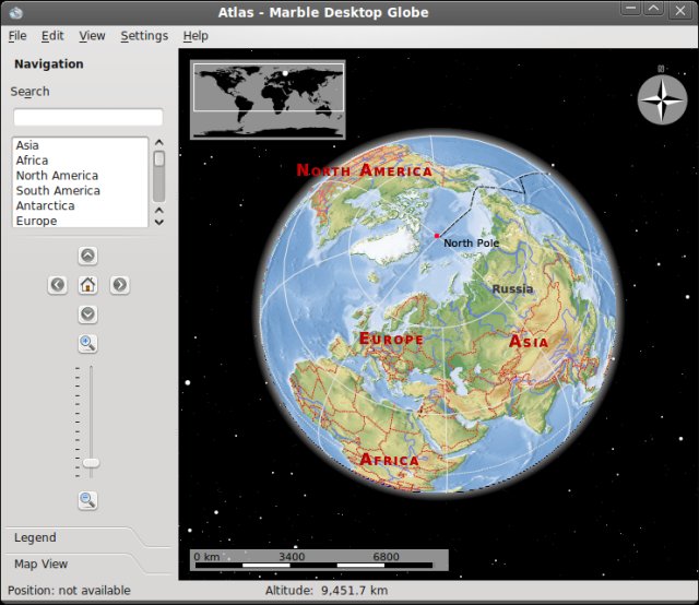


You can either use the mouse buttons of the navigation utility to scroll and zoom. You can also search for locations, if you do not know where they might be.

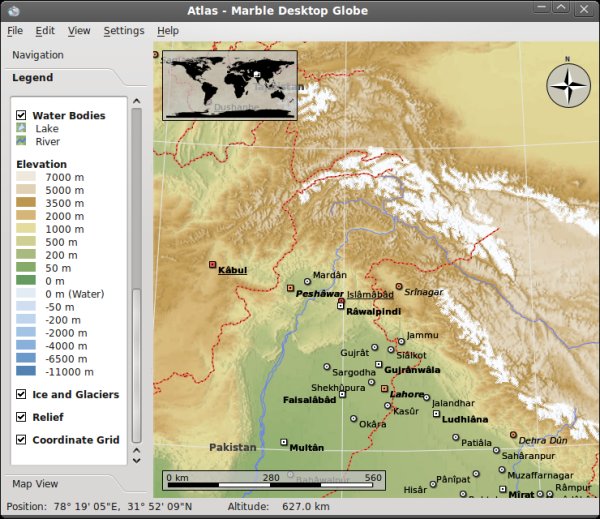
City information
The maps are fully interactive. Click on any city and you will get encyclopedia (wiki) results for it, including the Coat of Arms, flag, a historical overview, imagery, and whatnot. In this regard, Marble is a living, breathing atlas.

Road maps
You can also watch Earth from the perspective of its transportational network grid.

Historical maps
Or you can see what people thought things looked like in the past. Marble will ask you to download missing maps whenever you change the View.

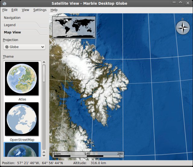
Satellite view
One of the best features, in my opinion, is the satellite imagery. You can zoom in on any bit of our planet and see authentic satellite images. Simply stunning.

Climate maps
You can also observe Earth's climate (temperature), in July and December:

Conclusion
Marble is a spectacular piece of software. It is beautiful, thorough, detailed, well laid out, fast, robust, and responsive. And you can enjoy it without any needs for a powerful graphics card. It runs well on modest hardware, which only makes it even more wondrous.
For people who like geography, Marble is a great bonus. It also seems like an excellent tool for teaching people (and kids) the wonders of our Planet in a fun and exciting way. I wish I had something like this when I was growing up!
Marble is simply great. You have to try it!
Again, thanks go to Searching_ _ _ for this discovery.
Cheers all.